Why Going Spatial Matters
In this day and age, GIS is no longer an optional luxury for water management systems. It is a necessity.
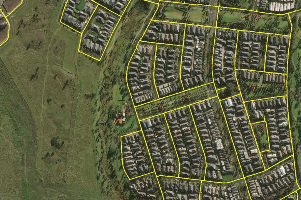
Data on assets such as pipes, valves, hydrants, and meters live in tables containing gigabytes’ worth of information. A Geographic Information System (GIS) adds spatiality to this data, making it more valuable and accessible to water utility companies, their partners, and technicians on the field. For instance, planning a water loss management or network rehabilitation project requires a bird’s eye view of your assets. A spreadsheet can sort pipelines according to age, repair history, priority level, and many other categories. However, you get further insight by seeing the same information laid out on an interactive map.
According to the Environmental Science Research Institute (ESRI), GIS benefits organisations through “improved communication and efficiency as well as better management and decision making.” True indeed, GIS products can help water industry professionals plan their operations better. They can address issues more efficiently, reduce operational costs and energy consumption, and minimise losses due to delayed response.
Harnessing the advantages of location intelligence
Whenever you ask a “where” question, GIS can help. Where can we find the most critical assets? Where are hazards and constraints located with respect to the distribution network? What are the risks, and where are they? These and other related enquiries are all geospatial.
GIS apps allow you to pull different types of locational data from various sources to address these questions. You can georeference plans and record drawings to convert them into digital versions of your pipelines, valves, hydrants, and water network features. Similarly, you can overlay them with cadastral maps, road networks, topography, land use, and spatial data downloadable from government websites.
In some instances, locating assets is a challenge due to a lack of accurate drawings, the nature of the terrain, or the age of the water network. GIS can aid you in narrowing down your search. For example, examining historical satellite imagery can provide leads about the pipe alignment. With luck, you can even find an aerial photo of the pipeline during construction and mark the coordinates on your map.
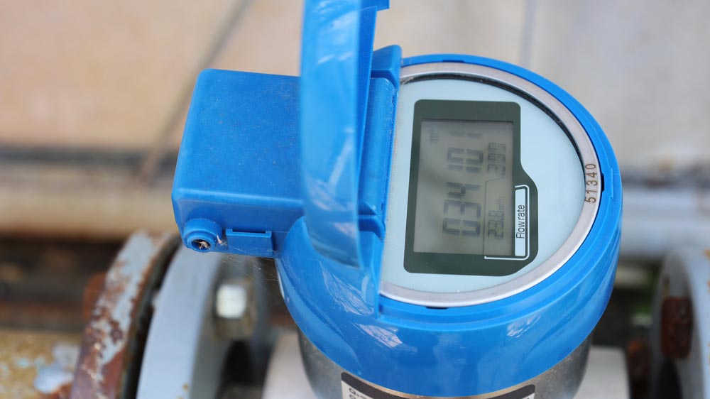
Accurate maps are essential to carry out work with maximum accuracy and minimal disruption if excavation is required. Using various GIS-enhanced methods and Global Positioning System (GPS) tools, one can pinpoint a leak’s location on the map with a sub-meter accuracy or even better.
With an accurate GIS, you can make data-driven decisions and know exactly where your assets are
Mobile GIS for fieldwork
Viewing and updating water network information is equally crucial on the field as on a desktop. Field technicians now use GIS-enabled apps on their phones and tablets to plan inspection routes and record their findings for the day.
These mobile field apps allow field technicians access to information on the assets they’re interacting with on-site. Likewise, they can submit reports, attach photos, and even update maps remotely.
GIS tools can be customised to suit the task at hand, including active leak detection and valve condition assessment, based on project goals and objectives. It also reduces the chance of data losses and human error when recording data, compared to writing everything down with a pen and clipboard. Mobile GIS and spatial data capture solutions are beneficial to technicians who perform active leak detection every day.
The future for GIS and fieldwork is shaping to be interesting as well. In the coming years, Augmented Reality (AR) will be used in the field to visualise complex networks of pipes with varying diameters and depths from the ground.
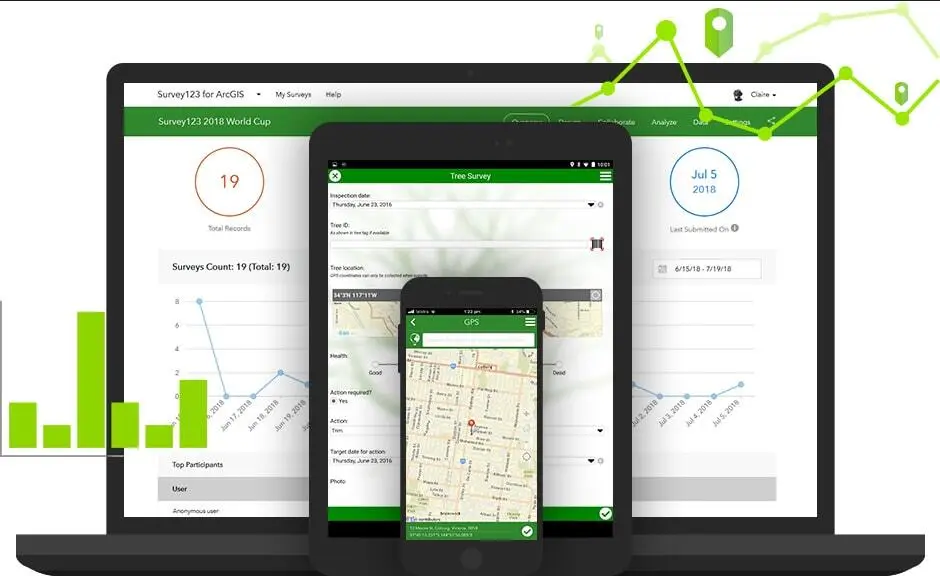
Mobile GIS and inspection apps like Survey123 allow seamless integration of desktop and field mapping (Photo courtesy of ESRI ArcGIS)
Real-time reporting and water network management
A water utility GIS can also be integrated into various leak detection and pressure transient monitoring platforms. When smart water meters or acoustic sensors detect anomalies, these can trigger alerts and alarms. With geographic data available on-demand, water companies can immediately locate and mitigate the problem leading to better customer service outcomes.
Additionally, GIS can communicate with Internet of Things (IoT) devices. These allow rapid and remote data collection for most water loss management projects. Such data-enabled equipment aids in building smart water networks and promotes the reliability and longevity of water utilities.
The advantage of these tools is that they are scalable based on the nature and scope of an operation. Water companies can opt to create map dashboards to monitor their hydrophones while integrating them into their Supervisory Control and Data Acquisition (SCADA) system or smart water network software platform. These solutions can be used to inspect a single short pipeline or manage dozens of metered water distribution zones simultaneously.
GIS and Water Network Management Services from Aqua Analytics
Aqua Analytics has pioneered smart water network management solutions in Australia, New Zealand, and Asia. With more than 20 years of experience, our team has solid background and knowledge in this space and can assist with the digitalisation of existing water network management projects and workflows.
We help water utilities implement digital solutions to help reduce water loss, establish intelligent water networks, active leak detection, and real-time IoT pipeline monitoring. Using cutting-edge technologies and GIS tools, we deliver accurate and timely results that provide actionable insight. Moreover, our maps and reporting systems can be customised to suit our clients’ GIS and asset management systems and their overall project goals and objectives.
Please call us at 1800 264 262 (AU) or 0800 345 697 (NZ) or visit our contact page for more information.
